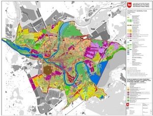
WHAT KAUNAS WILL LOOK LIKE ACCORDING TO THE NEW GENERAL PLAN OF THE CITY? 1
According to the minutes of KAUET of 2010 01 20
www.kamane.lt, 2010 01 31
In brief: The second amendment of Kaunas City General Plan was considered in the first meeting of Kaunas Architecture and City Planning Experts’ Council (KAUET) in 2010. The amendment may determine the preservation or destruction of unique urban, architectural and natural values in Kaunas.
The customer of the second amendment of Kaunas City General Plan is the administration of Kaunas City Municipality; it was prepared by the municipality institution Kauno Planas and presented by Laurynas Byla.
The meeting was chaired by Evaldas Barzdžiukas.
G.Šinkūnas: The project does not encompass the entire territory but analyses the changes of purpose offered in the territory 121. Kaunas City Municipality is going to prepare the new General Plan of the city in 2013.
N.Valatkevičius: The second amendment of the General Plan is the response to the need to change the use method of a particular territory; therefore, local issues are solved.
After the presentation of the second amendment of the General Plan and the discussion about the offered solutions, the experts expressed their recommendations:
1.1. The solutions of the General Plan should implement the decision to turn the city to rivers in zones near the rivers (7 experts).
1.2. The idea to plan a big harbour in Marvelė is not approved of: the number of industrial territories near the rivers should be decreased, and no new ones should be established. The freight harbour appears in the territory, which is the visit card of Kaunas (6 experts).
1.3. When the General Plan is prepared, it is necessary to prepare the special plan of Kaunas river quays (5 experts).
1.4. High-rise buildings should not be built in the Higher Freda (territory 74) as they will rise higher than the old town and will diminish the height of the slope visually (5 experts).
1.5. The conceptual strategic attitude is missing in the offered General Plan (4 experts).
1.6. The territory of S.Darius and S.Girėnas Airport should remain integral and undivided; therefore, its name should be marked unanimously (4 experts).
1.7. The urbanisation perspectives of Kleboniškis settlement near the Neris is planned without taking into regard the possibilities of relief. The territories near water could be recreational. It is necessary to show the solutions of infrastructure – the streets (4 experts).
1.8. It is offered to design the harbour zone near Marvelė as infrastructural and much smaller (the size of the territory should be based on analysis). The remaining territory should be left for mixed purpose, and there should be no industry in this place. The distance from water of 50 m should be preserved and it should be possible to view the old town from the detour (3 experts).
1.9. The experts approve of changes to commercial purpose in Žemieji Šančiai; still, the zone should be divided according to the network of streets typical of Šančiai (2 experts).
Prepared by Jūratė Merkevičienė


